he claim to sovereignty that states make rests upon their ability to assert territorial jurisdiction over land to manifest that they can exercise any power over the land under their control. In the Indian subcontinent, the British colonial state asserted this jurisdiction through the process of land settlement. The postcolonial states of India and Pakistan both absorbed the terms, conditions and methods of this process in their own respective territories. There were, however, some remarkable exceptions where this process was either not carried out at all or was carried out only partially. The desert of Thar was one of those exceptions. Deemed of limited revenue value, Thar largely remained either above or in-between the state-designated land classifications, with the language of settlement having been employed here in irregular and limited ways. The land policies implemented in Thar both during the British rule and in the post-independence era also reflect this ambiguity – until coal mining came along.
This essay aims at delineating traditional land rights and land utilisation practices in Thar, followed by an examination of their transformation and
reconfiguration as they were brought in contact with coal extraction activities. In doing so, the essay will also shed light on the quality of remedial measures
introduced by the state in response to land acquisition for coal development.
Imagining Thar
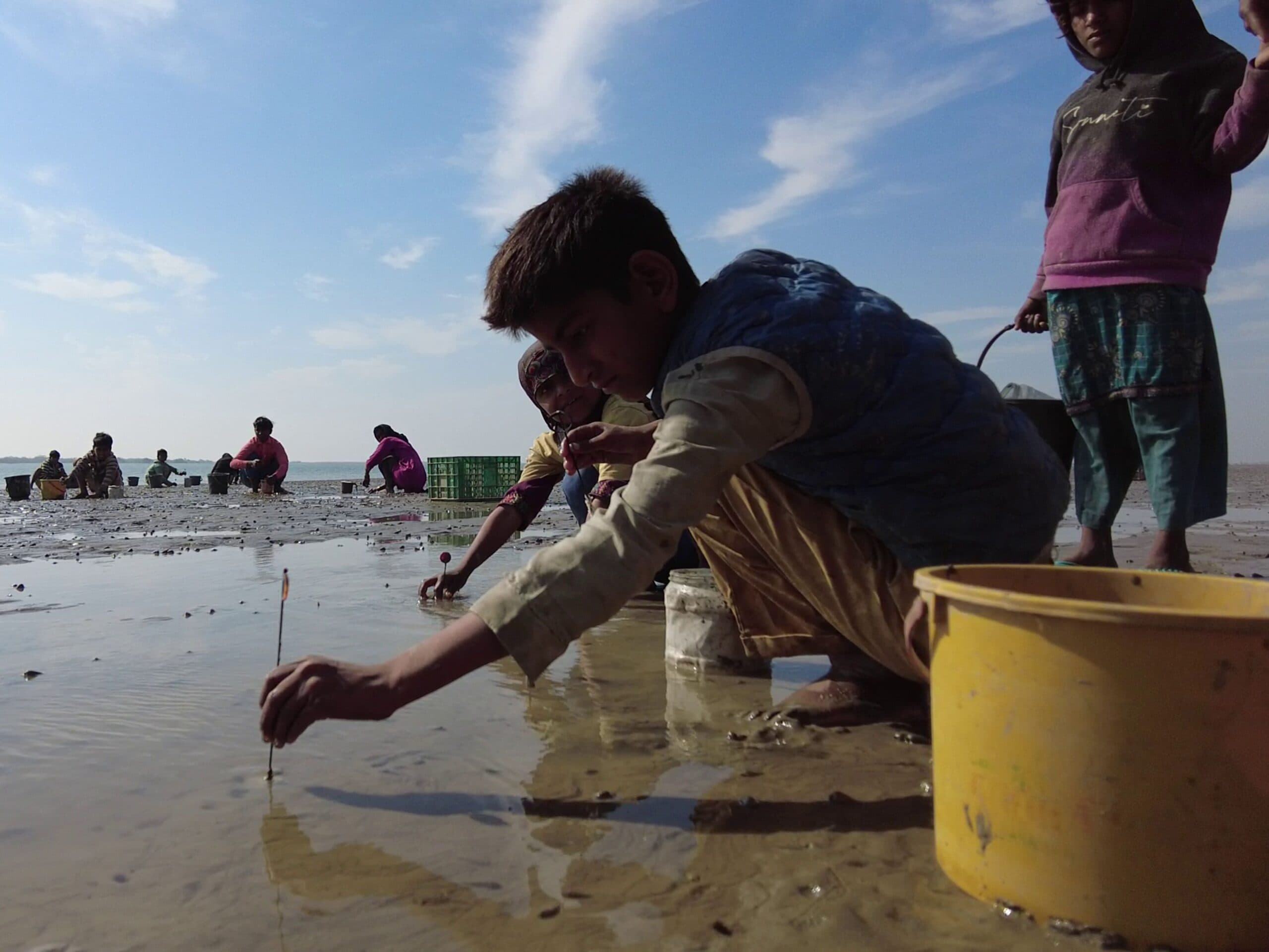
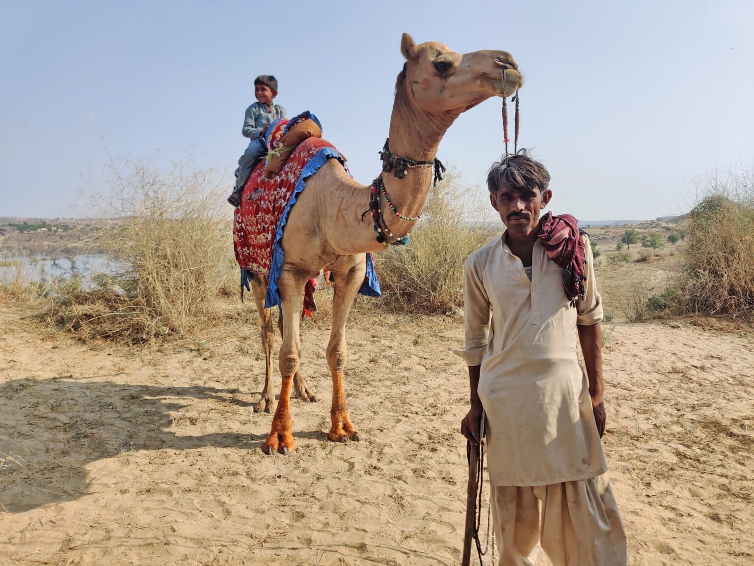
Land records tell us that, historically, upper-caste Hindus controlled and managed land in Thar but this land was not strictly their private fiefdom. Lower-caste communities availed as much benefits from the land as did the dominating ones. While seasonal agriculture was a common practice in some parts of Thar, livestock rearing prevailed there as the primary source of livelihood, operating under a communal logic. Typically, each village had a portion of land earmarked for community uses such as animal grazing and water procurement. (Tharparkar – the district that spans over much of Thar’s part lying in Pakistan – even today has a very high livestock population per capita in spite of its challenging environmental conditions). This arrangement was centred on a material connection between people and communal resources. It helped communities living in Thar to benefit from their local resources without putting them under undue pressure.
By ignoring and then erasing this connection, Thar coal has created new challenges for Tharparkar and its residents.
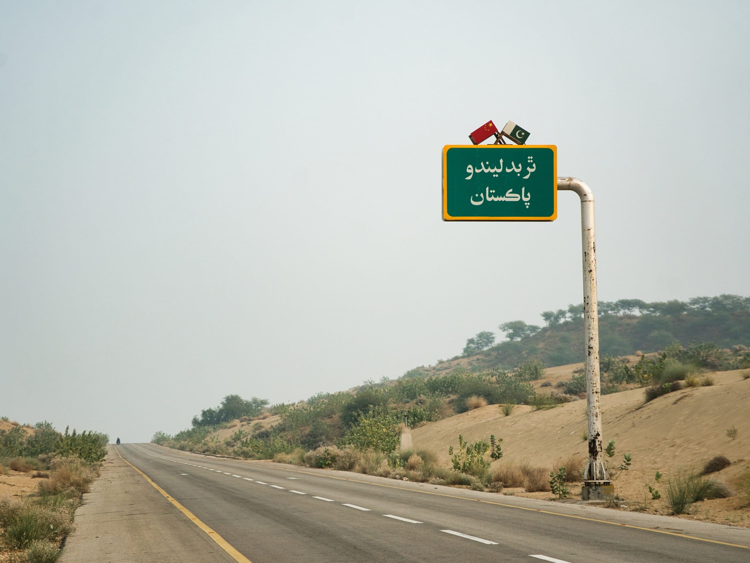
The proponents of Thar coal, on the other hand, claim that coal mining and coal-based power generation have brought Tharparkar into the 21st century. They argue that these activities are not just modernising the desert’s old ways of living, Thar is, in fact, transforming Pakistan as a whole – or, as they say in Urdu, Thar badlay ga Pakistan. The changes they tout include the creation of employment opportunities, monetary compensation paid for lands and homes taken over for coal mining, metalled roads and the construction of a model village for those displaced by coal-related activities.
Given the contradiction between what the residents of Tharparkar claim to have lost and what the supporters of coal development claim to have ushered in, it is important to analyse the veracity of these mutually exclusive contentions. Since coal mining and coal-based power generation would not have been possible without a large-scale land acquisition from Tharparkar’s residents, land occupies a central and critical role in this analysis.
As mentioned earlier, land utilisation and land ownership patterns in Tharparkar are significantly different from the ones in other parts of Sindh province. This is mainly because those parts of the province have gone through a process commonly known as land settlement – a colonial term that connotes enclosure of land through its mapping, recording of its ownership and fixing of its utilisation rights.
This process was never undertaken in Tharparkar – not at least systematically and comprehensively. Consequently, its patterns of using, sharing and transferring land often followed its unique traditional patterns.
Coal development, however, renders these traditional modes of land use and land ownership unviable and devoid of any normative and economic value. It, instead, concentrates these values in documents which, even in the best-case scenario, exist in Tharparkar only partially. These standardised documents undermine the significance of traditional practices and historical patterns of using land as a source of communal livelihood. The state, therefore, refuses to recognise any practices and usages outside of its documentation-based system.
This problem is exacerbated by the archaic and problematic practice of land acquisition under the colonial era’s statutory framework of Land Acquisition Act, 1894. Much has been written about the nature and application of this law. Here it is pertinent to note that even the limited protections that it offers to occupants and owners of land were not enforced during land acquisition in Tharparkar.
For example, public hearings before land acquisition – which are a prerequisite under the act – were seldom held in Tharparkar. Local communities also complain that the government often disregarded its own rules and regulations while taking away their lands for coal development. A few go to the extent of accusing the government of using strong arm tactics to silence their protests over what they call a totally flawed process of land acquisition.
The Land in Law
Land grant policies formulated in 1930, 1986 and 2000 mention three distinct categories of land in Thar, each with its own rules for adjudication, acquisition and disposal.
First of these categories is qabuli. It refers to privately owned and settled/surveyed land. The second category is yaksala. It refers to land taken on a tenured lease from the state. Its tenants have the option to become its owners after a certain period — usually five years — if they meet certain conditions. These conditions included transforming the leased land into cultivable agricultural farms. The third category is asaish and gaucher: it is essentially land being used for easements/amenities and grazing pastures.
Qabuli or privately-owned land constitutes the smallest part of all land in Tharparkar. Is it because most of the local land has not been subjected to an official settlement/survey? Or is it because complex traditional relationships with land resist its simpler categorisation into private and state land? The answer is both.
In theory, records of private land are maintained in a register with complete details of ownership, including the names of owners, possessors and cultivators. The register also contains survey numbers and other ancillary information. The practice and culture of documentation and record keeping, however, have never taken strong roots in Tharparkar. Official capacity to maintain and update land records has remained limited and local people talk of several incidents of fires and neglect which are reported to have destroyed a large part of these records. These limitations have serious consequences as far as land rights are concerned. Simply put, absence of records means absence of these rights.
Similar problems abound in the records of yaksala land. Its record is maintained in a separate register called hameshgi yaad-daasht (permanent notebook) which is not updated regularly and, thus, has patchy and partial details. Many Tharis have lost their lease tenures and, consequently, their right to land ownership due to these problems.
The contrast between how tenured leases are allotted and how land ownership rights can be acquired also show the whimsical nature of the state’s treatment of Tharparkar’s land. While the lease process requires public announcements and public gatherings at conspicuous locations so that everyone concerned can participate in it, acquiring ownership rights only needs a visit to the revenue office to fulfil some documentary requirements.
In the past, those who could not change their leases into ownership were not ousted from their farmland. This changed with the advent of coal mining. The state took away land from many cultivators who had not changed their leases into ownership – and also did not compensate them for their loss. These cultivators mostly, if not entirely, belonged to marginalised Hindu tribes and castes.
Besides survey and yaksala lands, Tharparkar also has gauchers – or communal grazing pastures. These pastures, also called charagahs, form the largest part of the geographical expanse of Tharparkar district and are the most important type of land for local pastoral tribes and communities. Ironically, gauchers also constitute the single largest part of the land designated as Thar Coalfield Blocks.
Grazing lands in Tharparkar have always had a protected status. This was so even during the British colonial era. The 1930 land policy stated that common land, natural resources, cultural landmarks as well as land located within 20 chains of a tarai-tobho (rainwater pond or well), within 10 chains of a mukam/graveyard or within five chains of a hamlet were immune from land acquisition and could not be given in private ownership. (A chain is a unit of length equal to 66 feet or 22 yards). Under this policy, special lists were maintained of tarais, wells and land reserved for grazing to ensure that no change was made in their status.
The principle of not giving anyone ownership rights over common land was maintained in the 1986 land policy. This policy stated that land lying within the vicinity of established gauchers, roads, paths or within a two-mile radius from a town could not be given in private ownership.
The 2000 land policy expanded on this and declared land within a five-kilometre radius from Mithi, the district headquarters of Tharparkar, was reserved common land. This policy also prohibited the use of that land for any purpose other than the one it had been previously reserved for.
The main point to be highlighted here is that grazing land – and other types of common land – had a unique communal character in all the three official policies mentioned above. This land could neither be called state land nor could it be given in private ownership. Its historical and communal character needed to be preserved.
Special Protection for Grazing Land
A number of schemes introduced under the Land Colonisation Act, 1912 reinforce the unique communal character of grazing lands and protect them from unbridled private ownership. Under section 10(2) of the Act, common lands such as gauchers could be given only on tenured lease to those who could put them to a better use. These leases were also subject to several conditions, listed in a notification issued on February 7, 1968.
The notification states: “Provided that such state land [is] situated 10 miles of the outer limits of a first-class municipality, 5 miles of the limits of other municipalities/Town Committees/Cantonment Boards, one mile from a railway station and that earmarked as Charagah, shall be leased out for a period of 3 years…”
Another notification issued on April 24, 1971 lists the communal lands that cannot be leased out. It reads: “2. Exceptions. The following categories of land shall not be leased out under these conditions:
“(a) land which lies within 10 miles of the outer limits of a Corporation, within five miles of the outer limits of a First Class Municipal Committee or within three miles of the outer limits of any other Municipal Committee/Town Committee.
“(b) Land which is already leased out for a fixed period, till the expiry of lease period or termination thereof whichever is earlier;
“(c) Land reserved as Charagah;”
Yet another notification issued under the 1912 Act on February 7, 1980 states that if and when a charagah has to be given on lease, the lease tenure cannot exceed two years.
The notification’s relevant part reads: “(ii) Such lands as are situated within the prohibited zones or comprise Charagahs be given on temporary cultivation leases by open auction for a period of two years in the lots not exceeding 12-1/2 acres per family to the landless tenants or self-cultivating owners of less than four acres of land.”
A government policy about charagah land dated February 4, 1998, similarly states: “The Charagah land around the village abadis as also along with roads shall not be converted into State land and shall not be used for any purpose except with the prior permission of the Board of Revenue and that for a public purpose only. A recommendation in this behalf should invariably be initiated by the District Collector through the Commissioner of the relevant division.”
The most salient feature bursting out of all the official documents cited above is that charagah land – on account of its immense public utility and communal character – could not be given into private ownership. And if, at any time, it was given on lease, the duration of that lease would not exceed a couple of years, with the explicit condition that this duration would not be renewed.
It is shocking how, in the presence of all these notifications, the state used the Land Acquisition Act to give gauchers and charagahs to coal development companies without any regard for their traditional status and/or communal nature. By doing so, it has not just violated its own policies, it has also overridden the historical claims of the people of Thar to use their commons.
Un-Surveyed Land
A huge portion of Thar’s land still lies beyond the ambit of law because of being un-surveyed. Such land has been declared as “stateless” under the law. This means that the state cannot claim it as its own land. A survey is a must to declare any land as either state-owned or privately-owned.
During the survey of any hitherto un-surveyed land, occupants and cultivators do not need to produce any document to stake their claim to the land under their occupation. They only need to back their claims with oral testimonies. A landmark judgment made in 2020 by the Balochistan High Court also reiterates the same principle in Sher Zaman versus the Government of Balochistan case. The court declared that possession and control over “unsettled land” by indigenous communities was a strong proof of their ownership of such land.
This judgment suggests that the lack of documentation cannot be an excuse for the state to refuse compensation while acquiring un-surveyed land from its occupants. In Tharparkar, however, none of the occupants and cultivators of un-surveyed land have been compensated after this land was acquired from them.
Too Little Too Late
Local communities in Tharparkar complain that the government has played the role of a silent spectator while their rights were being violated during land acquisition for coal development. Worse still, they allege, the government has been in collusion with coal development companies in that process, having helped them in reversing the fortunes of local people on a grand scale. They go on to add that it has only barely, if at all, provided resettlement and rehabilitation facilities to those displaced by coal mining and coal-based power generation.
As a matter of fact, both the federal and Sindh governments had no resettlement policies before coal exploration began in Thar. The earliest mention of such policies appears in the Sindh Coal Act of 2012. That law provided that any entity partaking in coal exploration or mining (or resulting power generation) must comply with the government’s resettlement policy. It, however, took the Sindh government another three years to come up with a resettlement policy framework for Thar Coalfield Blocks.
This framework acknowledged that a “substantial proportion” of the Thar Coalfield Blocks comprised the “common” or “community land”. Providing for the “provision of equivalent grazing land” for those whose gauchers or charagahs were taken over by coal mining, it asked coal developing companies to arrange alternative gauchers or charagahs on a “top priority” basis.
To put this principle into practice, the Sindh government needed to form an enforceable resettlement and rehabilitation policy in line with this framework. It took another eight years to come up with one.
This 2023 policy is full of flaws. Firstly, it is not enforceable since it is not backed by a provincial law. Secondly, it does not make any change in how land acquisition is done for a so-called public purpose, leaving it still susceptible to abuse.
More specifically, it does not weaken the wide-ranging powers of the Executive District Officer to unilaterally determine whether the need to acquire certain land is urgent or not. The policy also states that no legal appeals can be lodged or any objections raised against land acquisitions under the urgency clause of the Land Acquisition Act.
Thirdly, the entitlement matrix given in the policy is woefully inadequate. It restricts the option of land-for-land compensation only to privately-owned agricultural land acquired permanently. In the case of informal settlers or occupants without ownership title, it provides for compensating them only for the built structures on the land taken away from them – without explaining how the cost of those structures will be determined.
Most worryingly, the policy does not make the payment of compensation or resettlement as a precondition for land acquisition. This gives coal development companies a licence to displace people without having to ensure where, when or if they will be relocated or resettled.
To sum up, the land acquisition process in Tharparkar has been neither fair nor in line with local customs and traditions. While on the one hand, it has left hundreds of families aggrieved, displaced and penniless, it has also disrupted the harmonious relationship that people of Thar once had with their land and other natural resources.
This essay is the result of collective discussions at the Alternative Law Collective (ALC), a legal research organisation based in Lahore. The author is grateful to all those who participated in the discussions and enriched them with their inputs.